Finding the Source of the Hutch
- Hutchinson River
- Jul 22, 2025
- 2 min read
Updated: Aug 23, 2025
Finding the Source of the Hutch
The Hutchinson River Restoration Project was determined to find the true source of the Hutchinson River. So, one day, two of us set out to trace it to its origin. We left City Island and began our journey by car, following the river north along its banks.
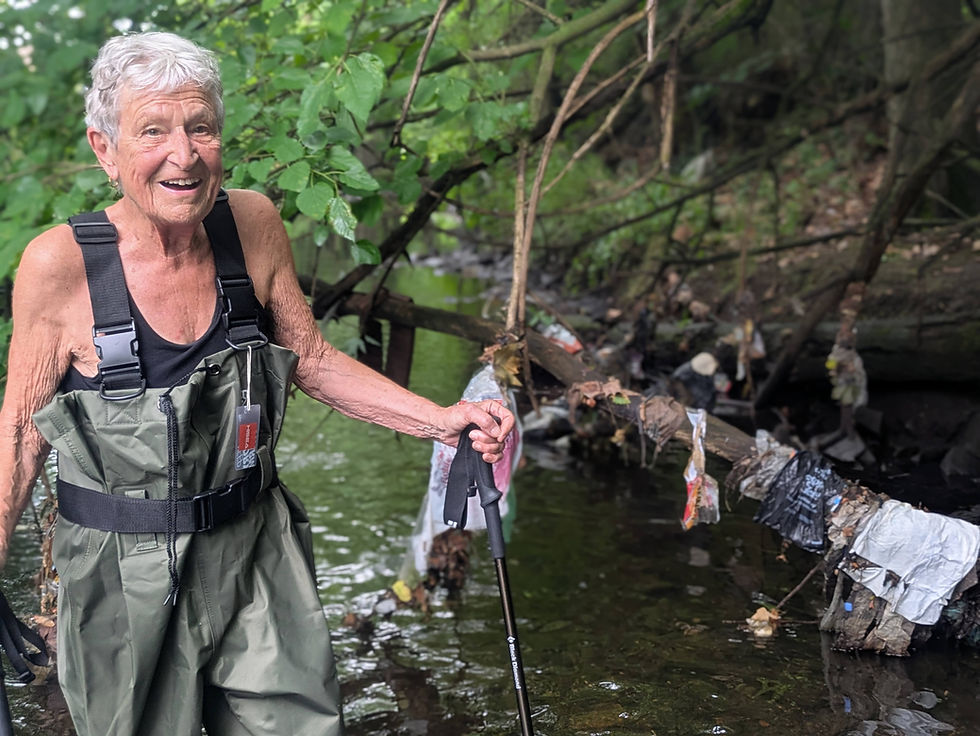
Our first stop was Glover’s Field, where we suited up in waders and started walking upstream. We quickly realized the terrain was more challenging than expected—large pools of water, slippery rocks, and unstable footing made the area difficult and even dangerous to navigate. So we headed back to the car and drove a little farther to Migui Park, a few hundred yards up the river.
There, the river was shallower and more passable. Surprisingly, we didn’t encounter much of the usual trash we typically find along the water until further upriver. Encouraged, we continued our mission. North of Wilson’s Woods, we reached a deep pond and attempted to enter at its northern edge. The shoreline was thick with foliage and deep, sludgy mud. One of us nearly got stuck—thankfully, we both had hiking poles to help us out.
Back in the car again, we followed the river through residential neighborhoods and along winding roads. The next section was heavily wooded, with many fallen trees and dense brush. It was hard to tell whether any litter was hidden beneath it all.
Eventually, we arrived at Twin Lakes/Nature Study Woods, a spot we had previously visited during Amelia Zaino’s Winter Walk Series. This area is relatively well-managed, though river access comes and goes. Past Reservoir Number 2, the river runs through backyards before entering Reservoir Number 3. From there, it parallels the Hutchinson River Parkway, dives under the road again, and reappears at Lake Innisfree—a private lake we couldn’t access that day.
Circling around the lake, we watched the river narrow again from a lake to a pond at the lake’s northeastern tip, disappearing once more into backyards. Pressing on, we followed small residential roads, checking maps and peeking into backyards to stay on the river’s trail. Finally, the map showed we were near the source!
We parked at the end of a dead-end road, pulled our waders back on, and stepped into what had become a muddy creek swarming with mosquitoes and surrounded by poison ivy. The sludge was thick and deep—it was clear we couldn’t move through it safely. So we hopscotched between the riverbank and the water, pushing ahead until we entered a quiet, wooded area with very wet ground.
That’s when we saw it—a large wet area of mud, not a slow seep or a trickle of water rising up from the earth. We had found it at last: the source of the Hutchinson River.


I envy and admire your fortitude in this endeavor. There is a nearby Givan Creek that has been filled and built upon by Freedom Land and latter Co-Op City. I'm sure it must still have its spots of resurfacing. Maybe you can advice me how to trace this Givans Creek?
How was the water quality? As expected for a less-urban point source? Any wildlife observed, eg., amphibians, reptiles, fish?